FieldNotes - Help Library
This section provides detailed information about software form and functionality; workmodes, tool options and in particular the input fields in forms and dialogs. The relevant help pages may be referenced directly from any form or dialog using the button.
Accessing Help Pages
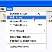
Help pages can be viewed
from within FieldNotes using
the menu.
The Help topics are split into four sections (Software Overview, Licensing Forms, Data Entry Forms and Classification Systems).